Our Services
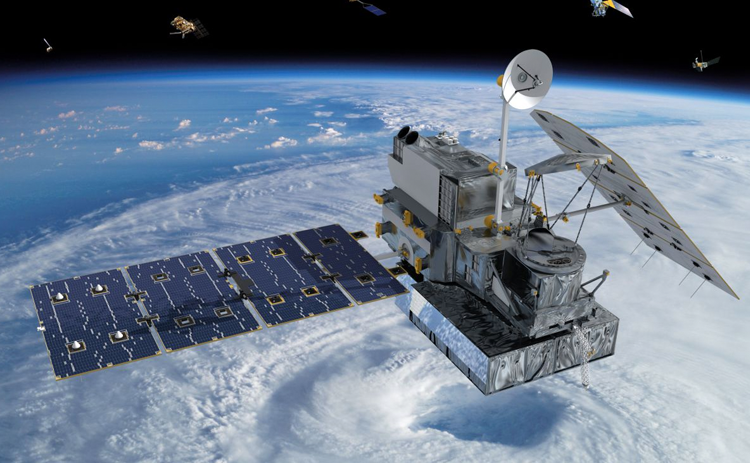
Geospatial Technology
Geospatial Technology
Acquiring earth georeferenced or geo-located data for modeling, simulating and visualizing features, regions, or events while utilizing technologies such as Geographic Information System (GIS), Remote Sensing (RS) and Global Positioning System (GPS).
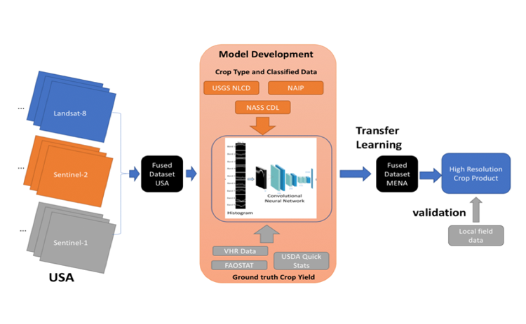
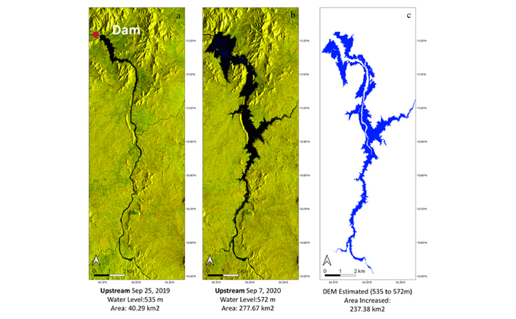
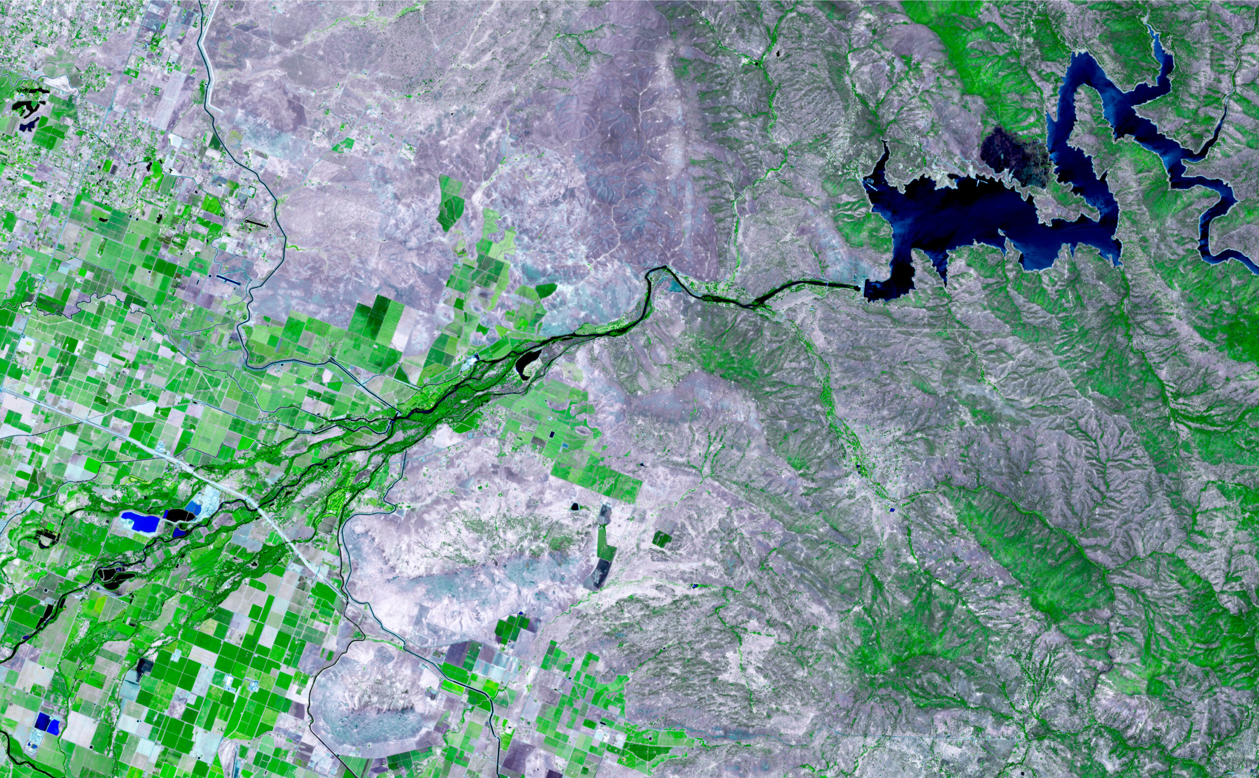
Multi-source remote sensing data fusion & Analytics
Multi-source remote sensing data fusion & Analytics
The multi-source data fusion used to integrate different spatial and spectral based resolution driven information from space or air borne sensors with ground to produce fused data that contains more detailed information than each of the sources does. The analytics approach involves the development and implementation of iterated composite of several directed modules based on the application. This includes and not limited to coastal mapping, crop estimation, and urban assessment.
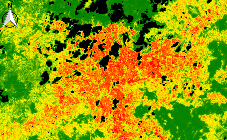
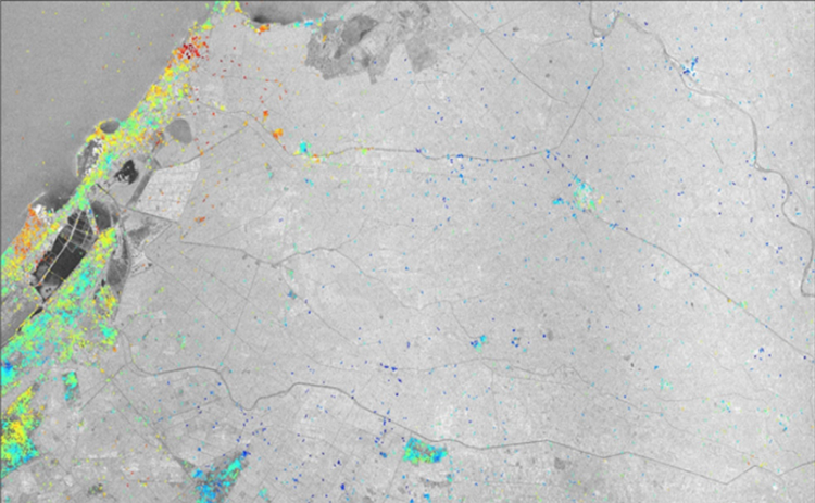
Change Detection
Change Detection
Change Detection Analysis encompasses a broad range of methods and complex techniques utilized to outline, identify, describe, and quantify differences between images, events or phenomena of the same scene at different times or under different conditions.
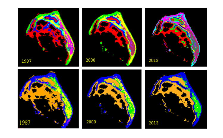
Urban Sustainability modeling
Urban Sustainability Modeling
Urban sustainability modeling used to improve the understanding of historical urban expansion, its socioeconomic drivers, and potential future urban expansion while addressing the potential environmental challenges and hence develop proper mitigation and adaptation strategies.
Environmental studies, analysis and mitigation
Environmental studies, analysis and mitigation
Identify and assess impacts likely to result from the anticipated problem, including emergency operations (including environmental, public health impacts and socioeconomic, as applicable). This includes social and health impacts that assess the social & cultural consequences and effects on health that are likely to follow from the problem. Mitigation Measures: Identify, assess and recommend feasible and cost-effective measures that may reduce potentially significant adverse environmental, socioeconomic and/or public health impacts to acceptable levels.
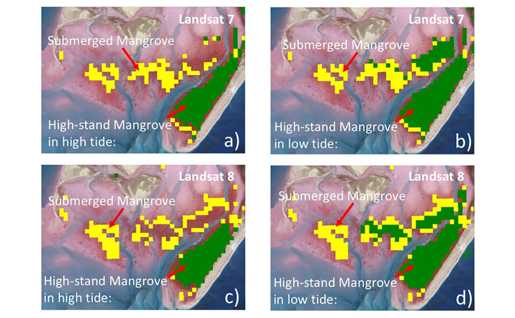
Assessment of sensitive marine habitats
Assessment of sensitive marine habitats
Assessing coastal habitats and map the potential biotopes including sensitive habitats, such as coral reefs and seagrass beds in the project area using remote sensing techniques and from published resources.
Assessment of Water and Sediment quality
Assessment of water and sediment quality
Evaluate hydrographical parameters, such as nutrients, chlorophyll a and contaminants in seawater using previous data from benchmarks. This is carried out to evaluate the level of inorganic and organic contaminants in surficial sediments using satellite and ground based available datasets.
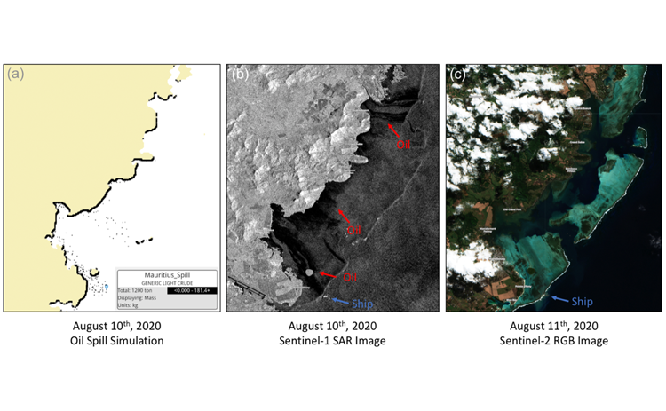
Oil Spill Analysis and modeling
Oil Spill Analysis and modeling
Oil spill modeling assesses the trajectory and fate of accidental oil spills to investigate the potential effects of accidental oil spills resulting from a surface oil spill from different sources.
Air dispersion modeling
Air dispersion modeling
Atmospheric dispersion modeling assesses the impact on the ambient air quality from the emissions associated with the accidental releases or leakages of atmospheric emissions from different sources.
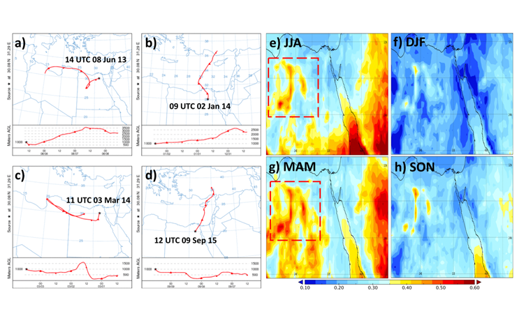
Solar Forecasting and Mapping techniques
Solar Forecasting and Mapping techniques
The ability to monitor, forecast and manage the surface solar energy with the use of space technologies is useful mainly in decision making for the energy producers that exploit photovoltaic or concentrated solar power plants as well as for the electricity transmission and distribution system operators. Estimating and forecasting the impact of particulate matter on solar energy by exploiting the synergy of Earth observation based aerosol observations and forecasts from sensors and products with a state-of-the-art solar irradiance simulation system. This service takes into account the dust effect on solar energy production. The economic and energy impact can be quantified in terms of monthly means, total Financial Loss and solar energy potential, by using the our satellite based forecasts.
Location Intelligence Analysis
Location Intelligence Analysis
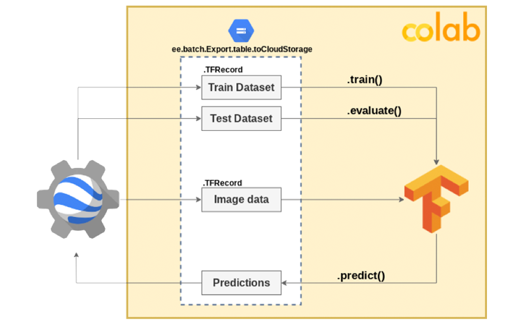
Geospatial AI Services
Geospatial AI Services
Leveraging the power of cloud and supercomputing, Geospatial AI techniques are utilized to learn, validate, forecast and identify impactful insights using earth observations data.
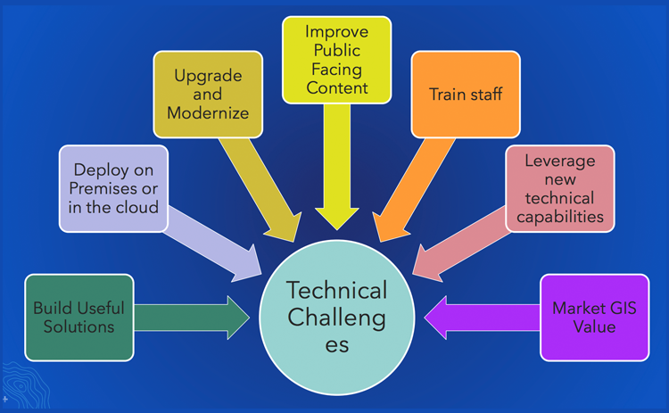
Geospatial Strategy Development
Geospatial Strategy Development
A Geospatial Strategy is a business- oriented plan that defines how an organization will use GIS & remote sensing to achieve its goals and desired outcomes. The plan includes considerations of people, process, and technology needed to meet goals and overcome challenges.
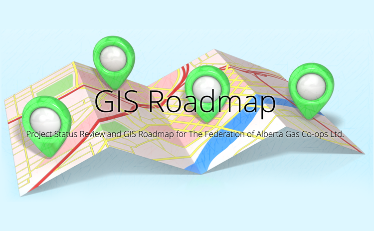
GIS Roadmap
GIS Roadmap
The roadmap is an outcome of the Geospatial Strategy to sequence the prioritized activities that come out as a result of having this Strategy.
Location Value Assessment (LAV)
Location Value Assessment (LVA)
(LVA) is a step-by-step activity that allows an organization to determine which workflows can benefit from the addition of location information
Training and Building Capacity Services
Training and Building Capacity Services
Our training programme targets specific case studies that are most relevant to trainees. This is based on providing most focused set of short courses that ensure maximum interactivity.